GPS and Satellite Navigation
Abstract
The Global Positioning System began as a U.S. military project of the 1970s and became civilian infrastructure that ride-hailing, aviation, agriculture, telecom networks, financial-market timestamps and the clock on a phone all depend on. A receiver finds its position by measuring how long radio signals took to arrive from satellites about 20,200 kilometers overhead, to within billionths of a second, and solving for the one point in space and time consistent with all of them. The satellite clocks run 38 microseconds a day fast because of relativity, and the system corrects for it. This article follows satellite navigation from the Sputnik Doppler measurements of 1957 through Transit, the 1973 Pentagon meeting that fixed GPS’s design, the Gulf War, the switch-off of Selective Availability in 2000, the GPS chip in every phone, the rival constellations of Russia, Europe and China, and the jamming and spoofing that now shadow all of them. It is the location layer beneath the mobile computing revolution.
Before Satellites
Ships and aircraft were navigating by radio long before anything orbited. LORAN, developed in the early 1940s, measured the difference in arrival time of pulses from pairs of ground transmitters; a navigator plotted the result on a chart of hyperbolic lines. In the 1970s the Omega system extended the idea to worldwide coverage with very-low-frequency transmitters. Both had the same limits: ground stations could cover only so much of the planet, accuracy was measured in hundreds of meters to kilometers, and none of it gave altitude.
The idea of navigating by an artificial moon is older still. In 1869 Edward Everett Hale published “The Brick Moon” in the Atlantic Monthly, a story about a brick sphere launched into orbit as a reference point for sailors working out their longitude.
Sputnik and Transit
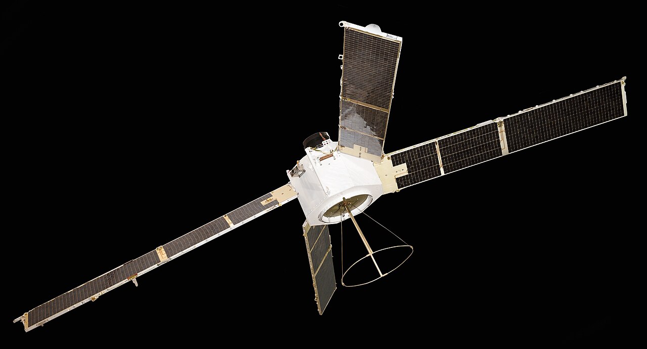
Satellite navigation began within days of Sputnik’s launch on 4 October 1957. Two physicists at the Johns Hopkins Applied Physics Laboratory, William Guier and George Weiffenbach, listened to the satellite’s radio beacon and noticed the Doppler shift: the tone rose as Sputnik approached and fell as it receded. From the shape of that curve they could reconstruct the whole orbit. In March 1958 their colleague Frank McClure asked the inverse question. If the orbit were known in advance, the same Doppler curve would tell a listener on the ground where they were.
The Navy wanted exactly that for its Polaris missile submarines, which needed a precise starting position before a launch. The result was Transit. The first satellite, Transit 1A, failed to reach orbit in September 1959; Transit 1B succeeded on 13 April 1960. The system entered Navy service in 1964 and was opened to commercial shipping in 1967.
Transit worked, but slowly. Its satellites flew low, about 600 nautical miles up with a 106-minute orbit, and a constellation of five was the minimum for reasonable global coverage, so a user often waited for the next pass. A single pass gave a fix accurate to about 200 meters, and computing it took about fifteen minutes on the shipboard AN/UYK-1 computer, a 550-pound machine with 8,192 words of 15-bit core memory. A submarine needed to expose its antenna for only about two minutes. Transit gave only a two-dimensional position and was useless for anything fast-moving, such as an aircraft. It kept running until 1996.
Timation and 621B
By the mid-1960s two other programs were attacking the problems Transit left open.
At the Naval Research Laboratory, Roger Easton (1921–2014), who had designed the Minitrack system used to track the first U.S. satellites, proposed navigating by time instead of Doppler. If satellites carried very stable clocks and broadcast their time, a receiver could compute its distance to each one from the signal’s travel time. His Timation program launched its first satellite in 1967 and a second in 1969, both carrying quartz oscillators, and showed that space-borne clocks could be precise enough. Easton’s later Navigation Technology Satellites carried the first atomic clocks into orbit: rubidium on NTS-1 in 1974, cesium on NTS-2 in 1977. NTS-2 transmitted the first GPS signals.
The Air Force had its own study, Project 621B, run with the Aerospace Corporation under Ivan Getting. Its contribution was the signal. 621B used pseudo-random noise codes, a spread-spectrum technique in which every satellite broadcasts on the same frequency but with its own long binary code, so that a receiver can pick out each satellite by correlating against the known codes. Tests at White Sands in New Mexico from about 1970 showed it worked even when the signal was buried below the noise. The technique, now called code division multiple access (CDMA), later became the basis of 3G mobile phones too (see Cellular Networks).
Each service was promoting its own design, and in August 1973 a Pentagon review board turned down the Air Force proposal because it was not a joint program.
The Lonely Halls Meeting
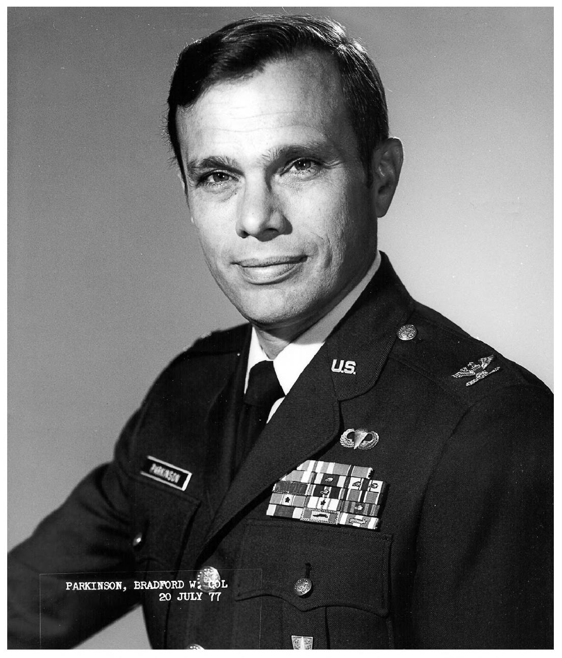
The officer told to try again was Air Force Colonel Bradford Parkinson (born 1935), who had taken over 621B in 1973. He held a Stanford PhD in aeronautics and astronautics and had flown 26 combat missions in Vietnam evaluating the AC-130 gunship’s digital fire-control system. Over Labor Day weekend 1973 he gathered about a dozen people, his own officer-engineers and two from the Aerospace Corporation, in a top-floor conference room of the nearly empty Pentagon. Later retellings add that the air conditioning was off for the holiday and the food came from vending machines. The participants called it the “Lonely Halls” meeting.
What they produced was a synthesis. From Timation came atomic clocks in orbit and ranging by time. From 621B came the CDMA signal. The decisions were:
- Passive ranging to four satellites in inclined orbits, so that the user needs no atomic clock (the fourth measurement solves for the receiver’s clock error).
- A CDMA signal with two codes: an encrypted precision code for the military and a freely available coarse code for everyone else.
- Two frequencies in the L band, so that military receivers can measure and remove the delay caused by the ionosphere.
- A family of receivers, including low-cost civilian ones.
The plan called for 24 satellites in 12-hour orbits at about 12,000 nautical miles, arranged so that four are visible from anywhere on Earth. The Pentagon approved it in December 1973 and the program was named NAVSTAR GPS. “The art of getting something through the Pentagon,” Parkinson said later, “is to get to a point [where] they don’t say ’no.’” Asked in 2023 how the system differs from what was decided that weekend, he said: “The fundamental answer is that it’s identical.”
Parkinson ran the program through the first launch, retired from the Air Force as a colonel after 21 years of service and joined Stanford in 1984. He and Getting received the Draper Prize in 2003. The 2019 Queen Elizabeth Prize for Engineering went to Parkinson, James Spilker (who designed the civil signal structure and the delay-locked loop that receivers use to track it), Hugo Fruehauf (the miniaturized rubidium clock) and Richard Schwartz (the radiation-hardened Block I satellites). Easton received the National Medal of Technology in 2006 and was inducted into the National Inventors Hall of Fame in 2010 for Timation. Who deserves to be called “the inventor of GPS” is still argued over, mostly between admirers of Parkinson and of Easton.
Building the Constellation
The first Block I satellite, built by Rockwell International, launched on 22 February 1978, with Parkinson as launch commander. Ten Block I satellites reached orbit between 1978 and 1985; one more was lost in a launch failure. They were designed for five years; several stayed in service for more than ten, and the last was retired in November 1995.
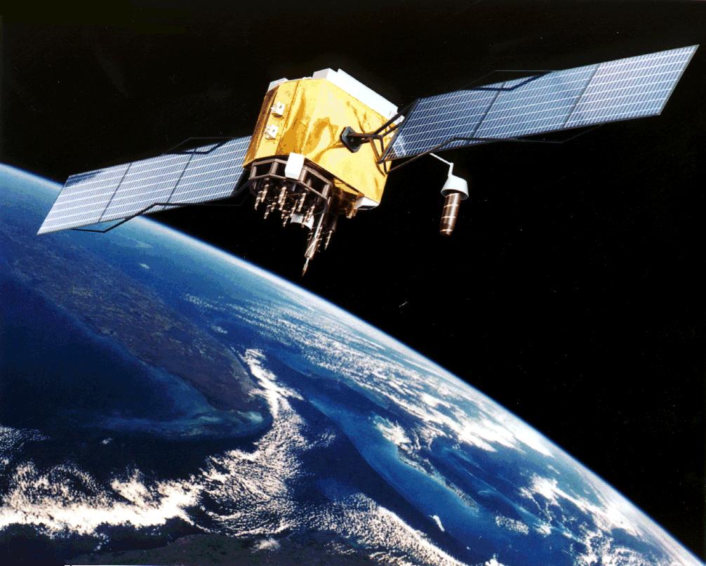
The operational satellites were meant to go up on the Space Shuttle, with 18 Block II satellites in orbit by the end of 1987 (budget cuts had reduced the planned constellation from 24). After the loss of Challenger in January 1986 the program office moved them to a new expendable rocket, the Delta II. The first operational Block II satellite went up on the first Delta II on 14 February 1989. The full 24-satellite constellation reached initial operational capability in December 1993, and full operational capability was declared in April 1995. Since the late 2010s the constellation has usually held about 31 operational satellites, more than the design minimum of 24, which improves coverage in cities and mountains. The satellites orbit at about 20,200 kilometers, in six planes inclined 55 degrees to the equator, and circle the Earth twice a day; from any point with a clear horizon about nine are usually visible.
Gladys West and the Shape of the Earth
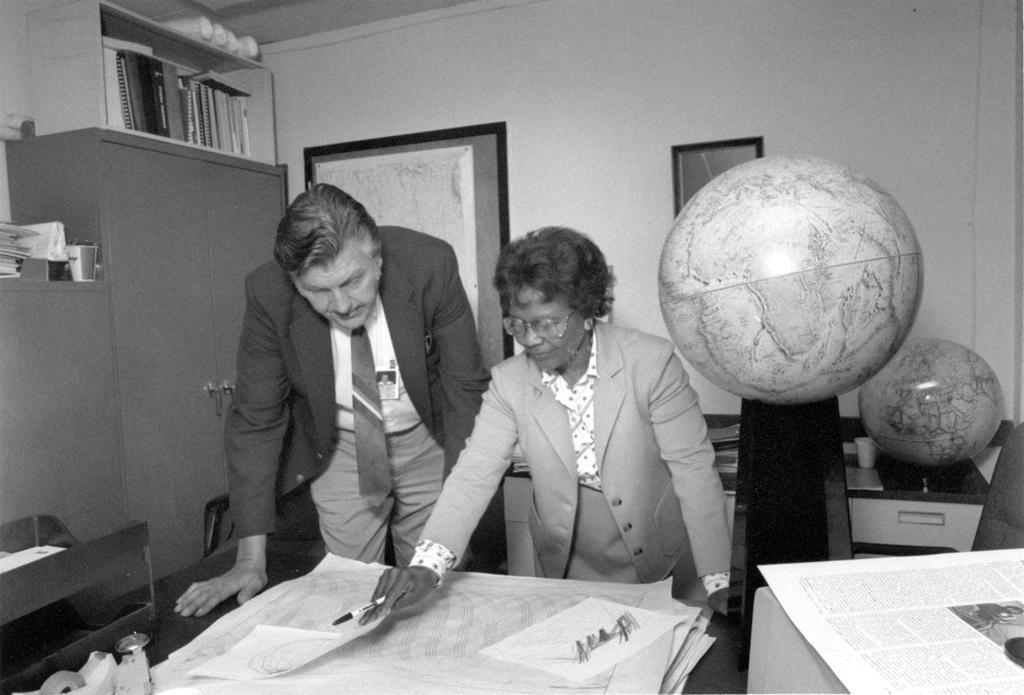
A position is only as good as the model of the Earth it refers to. The planet is not a sphere or even a neat ellipsoid; its gravity field bulges and dips, and the surface that a level ocean would form, the geoid, is lumpy.
Gladys West (1930–2026) was hired in 1956 as a mathematician at the Naval Proving Ground in Dahlgren, Virginia, the second Black woman hired there and one of four Black employees. She worked as a programmer on the laboratory’s IBM computers, including an IBM 7030 Stretch, writing software that calculated the shape of the Earth from satellite data with increasing precision, accounting for the gravitational, tidal and other forces that distort it. She became project manager for data processing on Seasat, the first satellite designed to remotely sense the oceans, and in 1986 wrote the data-processing specification for the GEOSAT radar altimeter, which improved the accuracy of geoid heights. Geodetic models of this kind are what GPS coordinates are computed against.
She retired in 1998 after 42 years at Dahlgren and finished a PhD in public administration by distance learning in 2000. Much of her work was classified and she rarely spoke about it, even to her children. It became known after a member of her sorority, Alpha Kappa Alpha, read a short biography West had submitted for an alumni function; in 2018 the Air Force inducted her into its Space and Missile Pioneers Hall of Fame, and the BBC named her one of its 100 Women. She died on 17 January 2026, aged 95.
The Three Segments
GPS is usually described in three parts:
- The space segment: the satellites, each carrying several atomic clocks (rubidium and cesium) and broadcasting its time and position.
- The control segment: ground stations that track the satellites, compute their precise orbits (“ephemerides”) and clock errors, and upload corrections, so that each satellite can tell receivers where it is and what time it is. Until September 2007 the master control station at Schriever Air Force Base in Colorado ran on a 1970s mainframe.
- The user segment: the receivers. They are passive and transmit nothing. A GPS receiver reveals nothing about itself to the satellites, which is why the system can serve any number of users.
How a Receiver Finds Itself
Each satellite broadcasts when its signal left and where the satellite was at that moment. A receiver compares the transmission time with its own clock to get the travel time, and multiplies by the speed of light to get the distance. One distance puts the receiver somewhere on a sphere around that satellite; a second narrows it to a circle; a third to two points, one of which is usually far out in space. The method is trilateration, from distances, not “triangulation,” which works from angles.
The difficulty is the receiver’s clock. Light covers about 30 centimeters in a nanosecond, so a clock error of one millionth of a second means an error of 300 meters. A receiver cannot carry an atomic clock, and its cheap quartz oscillator drifts by far more than that. Its error is the same for every satellite, though, so it can be treated as a fourth unknown alongside latitude, longitude and altitude. Four satellites give four equations, and the receiver solves for its position and its own clock error together. Every GPS receiver is therefore also a clock accurate to well under a microsecond, which is why GPS timing, more than positioning, synchronizes cellular base stations, power grids and financial-transaction timestamps.
Real receivers track many more than four satellites and do not solve the equations from scratch at each step. They combine each new set of measurements with a model of how the receiver is moving, using the recursive estimator published by Rudolf Kálmán in 1960. Phones and cars fuse GPS with accelerometers, gyroscopes and wheel sensors in the same way, which keeps the position smooth when a tunnel or a building briefly blocks the sky.
The Signal
Every GPS satellite transmits on the same frequencies, all derived from a single 10.23 MHz reference oscillator: L1 at 1575.42 MHz (154 × 10.23) and L2 at 1227.60 MHz (120 × 10.23). The receiver tells the satellites apart by their codes.
The civilian C/A code (coarse/acquisition) is a Gold code 1,023 chips long, sent at 1.023 million chips per second, so it repeats every millisecond. The military P code runs ten times faster and is so long that it repeats only once a week; in operation it is encrypted into the Y code. On top of the codes the satellite sends the navigation message at 50 bits per second: its clock correction and orbit in a 30-second frame, and the almanac (rough orbits for the whole constellation) spread over 25 frames, 12.5 minutes in total. That 50-bit-per-second rate is the reason an older receiver switched on cold could take many minutes to produce its first fix.
By the time it reaches the ground the signal is weak. The specified minimum received power for the C/A code is −158.5 dBW, about 10⁻¹⁶ watts, below the background noise of the receiver itself. A receiver recovers it by correlation: it generates its own copy of each satellite’s code and slides it in time and frequency until the two line up, at which point the correlated energy rises out of the noise. Early receivers had a single hardware channel and tracked satellites one after another. Modern chips run many correlators in parallel and can search many codes and Doppler offsets at the same time.
Relativity
GPS is the best-known everyday test of Einstein’s theories. Two effects act on the satellite clocks:
- Special relativity: the satellites move at about 14,000 km/h, so their clocks run slower than ground clocks by about 7 microseconds per day.
- General relativity: the satellites sit higher in Earth’s gravity well, where time runs faster, so their clocks gain about 45 microseconds per day.
The net result is that a satellite clock gains about 38 microseconds per day against clocks on the ground. Uncorrected, that would add roughly 11 kilometers of range error per day. The satellite clocks are therefore set slightly slow before launch: they run at 10.22999999543 MHz instead of 10.23 MHz, so that seen from the ground they tick at the right rate. Receivers apply a further correction for each satellite’s slightly elliptical orbit; in the early days the satellites lacked the computing power to do it themselves, so the job was handed to receiver software.
Not everyone in the program believed this was necessary. When NTS-2 carried the first cesium clock into orbit in June 1977, some engineers still doubted that the relativistic effects were real. The clock was fitted with a frequency synthesizer that could be switched on to apply the correction. For about 20 days it was left off and the clock’s rate was measured. It ran fast by 442.5 parts in 10¹² against the predicted 446.5, a difference well within the clock’s own accuracy. Then the synthesizer was turned on.
Desert Storm
GPS had its first war before it was finished. When the Army deployed for Operation Desert Shield in 1990, 16 satellites were in orbit, enough for three-dimensional fixes for about 19 hours a day. Military receivers were scarce; at the start the Army owned about 500. The Pentagon bought commercial units in bulk: about 4,000 Trimble AN/PSN-10 “Slugger” receivers (from SLGR, Small Lightweight GPS Receiver) and about 1,000 Magellan NAV 1000M handhelds that ran on AA batteries. Some soldiers had their families buy receivers at home and mail them out. Even so, of VII Corps’ 40,000 vehicles only about 3,000 had GPS. Because most of these receivers could use only the civilian code, the United States temporarily switched off Selective Availability during the war so that its own troops would get full accuracy.
In the desert, where there were few landmarks, the receivers were used to navigate the ground offensive, which began on 24 February 1991, and to position artillery. VII Corps commander Lt. Gen. Frederick Franks said they “were invaluable in avoiding fratricide and allowing accurate navigation and artillery fires.” Air Force chief of staff Merrill McPeak called Desert Storm “the first space war.”
From Military Secret to Civilian Utility
On 1 September 1983 a Soviet interceptor shot down Korean Air Lines Flight 007, a Boeing 747 that had strayed into Soviet airspace near Sakhalin, killing all 269 people aboard. On 16 September White House press secretary Larry Speakes read a prepared statement that the United States was “prepared to make available to civilian aircraft the facilities of its Global Positioning System when it becomes operational in 1988.”
Myth: Reagan opened the military-only GPS to civilians after KAL 007
GPS was designed for civilian use from the beginning. Deputy Secretary of Defense William Clements’s April 1973 memo setting up the joint program said “civil user needs should be considered,” and the 1974 program management plan described the C/A code as “a navigation signal in the clear to both the military and civil user.” Texas Instruments was already selling its TI 4100 receiver to surveyors before the shootdown, and every satellite then in orbit was broadcasting the civil signal. The 1983 statement was a political commitment that the civil signal would stay free; it was read by Reagan’s press secretary, and Reagan himself is not on record mentioning GPS. See Myths and Misconceptions.
The civil signal was free, but it was deliberately degraded. Selective Availability (SA) added a varying error to the satellite clock data, limiting civilian accuracy to about 100 meters. Differential techniques (below) were developed partly to get around it. On 1 May 2000 President Bill Clinton ordered SA switched off at midnight. The White House said civilian receivers would become ten times more accurate, to 20 meters or better, and the government began to describe GPS as a “global utility.” In 2007 the government decided that future GPS III satellites would be built without the SA capability at all.
The change was visible within days. On 3 May 2000 Dave Ulmer hid a bucket of trinkets in the woods near Beavercreek, Oregon, and posted its coordinates to the Usenet newsgroup sci.geo.satellite-nav. Within three days it had been found twice, first by Mike Teague. This was the first geocache. The first cache in Germany followed on 2 October 2000, and by 2017 there were more than three million worldwide. Car navigation, fitness tracking, precision agriculture and, eventually, the location services in every smartphone grew on the same foundation.
Receivers Get Small
The first commercial GPS receiver was the Texas Instruments TI 4100 NAVSTAR Navigator of 1981–82, a briefcase-sized unit for surveyors and geophysical crews that sold for $119,900, plus $19,950 for the post-processing hardware and software. It had a single hardware channel and stepped between satellites.
In 1989 Magellan sold the NAV 1000, the first handheld GPS receiver, mainly to boaters. It weighed 1.5 pounds, cost $3,000, stored 100 waypoints and read satellites one after another, updating its position every few seconds once it had a fix. Trimble (founded 1978) and Garmin (founded 1989) built businesses on receivers for boats, aircraft and surveyors, and in the 2000s on dashboard navigators for cars, a market described in Digital Maps and GIS.
The phone came next, pushed by regulation as much as by demand. The U.S. Federal Communications Commission’s Enhanced 911 rules, adopted in 1996 and tightened in 1999, required carriers to report the location of emergency callers, from 1 October 2001, to within 50 meters for 67 percent of calls when the position came from the handset. Satisfying that indoors and quickly required Assisted GPS: the network sends the phone the satellite orbits and an approximate time and position, so it does not have to wait 12.5 minutes for the almanac and knows which codes to search for. Apple’s iPhone 3G, announced on 9 June 2008, was one of the phones that took GPS into the mass market; in October 2009 Google made turn-by-turn navigation free on Android, and the market for standalone navigators began to collapse.
Getting More Accurate
Standard GPS gives a few meters. Augmentation pushes further. Differential GPS (DGPS) uses a reference station at a precisely surveyed location: the station compares its known position with what GPS reports and broadcasts the difference, which nearby receivers subtract. Satellite-based augmentation systems such as the FAA’s WAAS and Europe’s EGNOS send such corrections over geostationary satellites, good enough for aircraft approaches. Real-Time Kinematic (RTK) receivers go further by measuring the phase of the carrier wave itself, whose wavelength on L1 is about 19 centimeters, and reach centimeter accuracy for surveying, construction and autonomous farm machinery.
Navigation in the Car
Car navigation is older than GPS. A New York engineer, Joseph Jones, patented a route disc driven by the odometer in 1909, and paper-strip route guides followed into the 1930s. The first map-display system was Honda’s Electro Gyrocator, offered from 24 August 1981 in two models: a helium gas-rate gyroscope and a microprocessor moved a light spot across a plastic map overlay on a small cathode-ray screen. Nissan and Toyota showed systems the same year. In West Germany, Blaupunkt’s ALI guided drivers through induction loops in the road and a central computer, and in June 1983 its engineer Otmar Pilsak presented EVA, the first route-calculating system with spoken directions, which remained a prototype. In the US, Etak, backed by Nolan Bushnell, sold a map-display navigator with route calculation from 1985. Blaupunkt’s TravelPilot IDS, in series production from 1989, read its maps from CD-ROM and used wheel sensors and an electronic compass; the 1995 RG 05 model added speech and a GPS receiver, and BMW’s 750i had offered a built-in system with Philips electronics from 1994.
Keeping Time
GPS keeps its own time scale. GPS time started at midnight UTC on 6 January 1980 and has never inserted a leap second, while UTC has added 18 since then, so GPS time has been 18 seconds ahead of UTC since 1 January 2017. Each satellite broadcasts the current offset, and receivers that display civil time apply it.
The legacy navigation message counts weeks in a 10-bit field, which holds 0 to 1,023. Every 1,024 weeks, about 19.6 years, the counter rolls over to zero, and a receiver that does not know which 1,024-week era it is in jumps back by almost twenty years. The first rollover came on 21–22 August 1999, months before the better-known Y2K deadline. The second, on 6–7 April 2019, caught out some equipment that had been in service for years, including Honeywell flight-management and navigation software, which caused flight delays and cancellations. The next legacy rollover falls on 20–21 November 2038, close to Unix’s own 2038 problem. The modernized civil messages use a 13-bit week number, which will not roll over until 2137.
Time errors can also come from the control segment. On 25 January 2016, when the Air Force removed the oldest satellite, SVN-23 (launched in 1990), from the constellation, a fault in the ground software uploaded wrong time-correction data. For almost 14 hours, 15 satellites, half the constellation, broadcast UTC information that put GPS-controlled clocks off by about 13 microseconds. Positioning was largely unaffected, but timing receivers that synchronize telecom and broadcast equipment reported faults; the BBC said some listeners lost digital radio reception.
A Crowded Sky
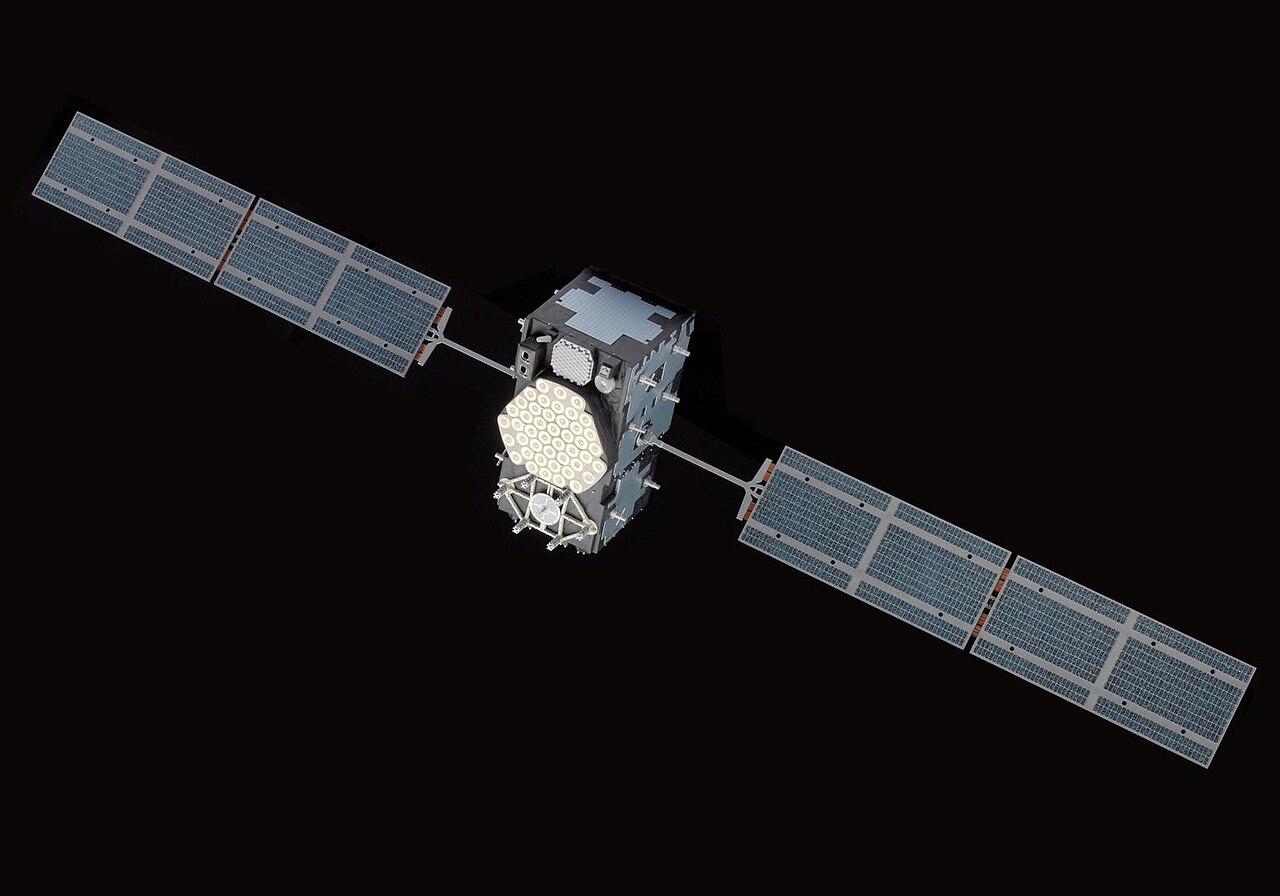
GPS is no longer alone. Dependence on a system controlled by the U.S. military led other powers to build their own; the generic term is GNSS, Global Navigation Satellite System.
- GLONASS (Soviet Union, then Russia): development began in 1976 and the first satellite launched on 12 October 1982. The constellation reached its full 24 satellites in December 1995, then decayed as Russia’s space budget collapsed in the late 1990s. Restoration became a government priority in 2001, and the full constellation was restored in October 2011. Its satellites fly lower than GPS (19,100 km) and at a steeper inclination (64.8 degrees), which gives better coverage at high latitudes. The original GLONASS signals use frequency division, each satellite on its own frequency around 1,602 MHz; newer satellites add CDMA signals compatible with the other systems.
- Galileo (European Union), the only one under civilian control. ESA discussed a European system as early as 1984; EU transport ministers approved it in 1999 at an estimated €2.2 billion, for completion in 2008. The first test satellite, GIOVE-A, launched on 28 December 2005, partly to secure the frequencies the ITU had reserved, and GIOVE-B sent the first full Galileo signal in 2008. The first operational satellites followed on 21 October 2011. Two satellites launched in August 2014 ended up in the wrong orbits, and by 2015 the expected total cost had grown to about €22 billion. Initial services began on 15 December 2016. From 11 to 18 July 2019 the whole system was unusable for six days, after an equipment failure in the ground segment’s Precise Timing Facility in Italy stopped the computation of new orbit and clock data. Since January 2023 Galileo has offered a free High Accuracy Service with about 20-centimeter precision.
- BeiDou (China) grew in three steps from a regional test system to global coverage. President Xi Jinping declared the third-generation system, BDS-3, complete at a ceremony in Beijing on 31 July 2020.
- Regional systems: NavIC (India) and QZSS (Japan).
Modern phone chips listen to several constellations at once. More satellites in view means better accuracy and fewer gaps in cities, where buildings block much of the sky and reflected signals confuse receivers.
Modernization and OCX
The GPS of the 2020s is a mix of satellite generations. New civilian signals were added: L2C on the second frequency, L5 at 1176.45 MHz (115 × 10.23) for aviation safety, and L1C, designed to be interoperable with Galileo. The first GPS III satellite launched in 2018.
The ground system did not keep up. The Next Generation Operational Control System (OCX), developed by Raytheon, was meant to command the new satellites and their modern signals and to be ready in 2016. It slipped year after year, and its cost ran past an earlier estimate of $3.7 billion. The Space Force formally accepted the system in July 2025, but integrated testing against the rest of the GPS enterprise turned up failures across so many functions that officials concluded that switching to it would put existing military and civilian service at risk. On 17 April 2026 the Space Force cancelled OCX after sixteen years of development and about $6.27 billion in spending. “The challenges of onboarding the system in an operationally relevant timeline proved insurmountable,” said Col. Stephen Hobbs, commander of Mission Delta 31. GPS continues to be run by the older Architecture Evolution Plan, the system installed in 2007, which Lockheed Martin is upgrading instead.
Dead End: The Vulnerability Nobody Designed Away
The weak signal that lets one design serve billions of passive receivers also makes GPS easy to disrupt. A transmitter of a few watts can drown out the satellites over a wide area. Jamming blocks the signal; spoofing replaces it with counterfeit signals that lead a receiver to a false position or time without raising any alarm.
Spoofing moved from theory to demonstration in the 2010s. In 2012 Todd Humphreys’s group at the University of Texas at Austin took control of a GPS-guided drone in a publicly acknowledged test. In June 2013 his students, on board the $80 million yacht White Rose of Drachs in the Mediterranean with the owner’s permission, used a briefcase-sized spoofer to overpower the real signals and steer the ship onto a track hundreds of meters from its intended one. “The ship actually turned and we could all feel it,” Humphreys said, “but the chart display and the crew saw only a straight line.” At the end of June 2017 at least 20 ships in the Black Sea reported that their GPS placed them at Gelendzhik Airport, about 32 kilometers inland, the first well-documented case of mass spoofing outside a laboratory.
Jamming has since become a routine part of electronic warfare. From late 2023, interference attributed to Russian sources affected tens of thousands of civilian flights around the Baltic. In April 2024 Finnair suspended its Helsinki–Tartu flights after two aircraft had to turn back because jamming prevented a GPS-based approach; the route resumed on 2 June, after Tartu installed a landing aid that did not depend on GPS.
Military receivers can use the encrypted code and antennas that null out jammers; Galileo’s Public Regulated Service is built with anti-jamming measures for government users. The billions of civilian receivers have neither. Because so much infrastructure relies on GPS for time as well as position, interest has returned to systems GPS was once expected to make obsolete: terrestrial radio navigation such as eLORAN, inertial navigation that needs no outside signal, and experimental methods that navigate by the Earth’s magnetic field or by “signals of opportunity” from other transmitters. Most of these are backups that few users have bought.
📚 Sources
- Heinz Nixdorf MuseumsForum blog, “Hier entlang – 40 Jahre Navigationssysteme” (24 August 2021) (Jones 1909, the Electro Gyrocator, ALI and EVA, Etak, TravelPilot, BMW 750i)
- Heinz Nixdorf MuseumsForum blog, “Schnitzeljagd mit Satelliten” (2 October 2020) (Ulmer’s first cache, the first German cache, cache counts)
- Geocaching, Wikipedia: Ulmer’s cache near Beavercreek, the sci.geo.satellite-nav post, found twice within three days, first by Mike Teague
- Heinz Nixdorf MuseumsForum blog, “Global Positioning made in Europe” (28 December 2015) (Galileo’s history from 1984, GIOVE-A and B, the 2014 orbit failure, cost estimates)
- Global Positioning System, Wikipedia: predecessors, Block I and II launches, IOC and FOC, orbit parameters, constellation size, OCS replacement in 2007, Collier Trophy, Draper Prize
- Transit (satellite), Wikipedia: Guier, Weiffenbach and McClure; Transit 1A and 1B; orbit, accuracy, fix time, AN/UYK-1; civil use from 1967; end of service in 1996
- Johns Hopkins APL: history: Guier and Weiffenbach’s Sputnik Doppler work and the Transit system
- Roger L. Easton, Wikipedia: Minitrack, Timation I and II, NTS-1 and NTS-2, honors
- Bradford Parkinson, Wikipedia: career, Vietnam missions, 621B, launch commander in 1978, retirement as colonel, Stanford
- GPS World, “First Fix: 50 years since ‘Lonely Halls’” (2023): the meeting’s participants, design decisions, Parkinson quotes
- Jim Mitcham, “‘The Lonely Halls Meeting’ and the world of GPS,” Madison County Journal: no air conditioning, vending-machine food
- GPS satellite blocks, Wikipedia: Block I builder, five-year design life, service lives, last Block I retired in 1995
- Wilson Quarterly, “Launching the Brick Moon: GPS’ path from the space race to smartphone”: Hale’s “Brick Moon,” Timation, 621B at White Sands, the August 1973 rejection, December 1973 approval, McPeak’s “first space war,” Parkinson’s Pentagon quote
- Queen Elizabeth Prize for Engineering: 2019 winners, the Global Positioning System: Parkinson, Spilker, Fruehauf and Schwartz and their contributions
- Richmond Free Press, “Gladys West, mathematician whose work enabled GPS, dies at 95” (22 January 2026)
- Gladys West, Wikipedia: life dates, Dahlgren, Seasat, GEOSAT, Stretch, retirement, PhD, honors
- GPS signals, Wikipedia: frequencies, C/A and P(Y) codes, navigation message, almanac timing, L2C and L1C
- Penn State GEOG 862: The Legacy Signals and Power Spectral Density Diagrams and MathWorks: GPS receiver acquisition and tracking using C/A-code: minimum received C/A power of −158.5 dBW (IS-GPS-200)
- Neil Ashby, “Relativity in the Global Positioning System,” Living Reviews in Relativity 6 (2003): the 10.22999999543 MHz offset, NTS-2 launch (23 June 1977) and relativity test (442.5 measured vs 446.5 predicted parts in 10¹²), receiver-side eccentricity correction
- Why does GPS depend on relativity? Ohio State / Astronomy: the 7, 45 and 38 microsecond figures
- U.S. Army, “GPS Goes to War: The Global Positioning System in Operation Desert Storm”: satellite count, Slugger and NAV 1000M numbers, VII Corps, Franks quote
- Science Museum, “GPS navigation: from the Gulf War to civvy street”: receiver shortage, family purchases, SA switched off during the war
- Richard Easton, “The origin of civilian uses of GPS,” The Space Review (11 June 2018): Clements memo of April 1973, the 1974 program management plan, TI 4100 before 1983
- Eric F. Frazier, “Stubborn GPS Myth Reaches Middle Age” (29 August 2023): the Speakes statement of 16 September 1983 and its wording
- The Cape, chapter 3, section 2: Evolution of the NAVSTAR Global Positioning System (Air Force history, via FAS): Shuttle plans for Block II, the switch to Delta II after Challenger
- Korean Air Lines Flight 007, Wikipedia: date and casualties of the shootdown
- Error analysis for the Global Positioning System: Selective Availability, Wikipedia: SA policy, Gulf War switch-off, accuracy impact, the 2007 decision to build GPS III without SA
- The White House, “Improving the Civilian Global Positioning System (GPS)” (1 May 2000) and GPS.gov: Selective Availability: the switch-off at midnight, “ten times more accurate,” 20 meters, “global utility”
- ION Museum: Texas Instruments TI 4100 NAVSTAR Navigator and Smithsonian: TI-4100 NAVSTAR Navigator: first commercial receiver, single channel, geodetic use
- Smithsonian National Museum of American History: GPS Receiver (TI 4100): introduction in 1982, $119,900 plus $19,950 for post-processing
- Smithsonian National Air and Space Museum: Magellan NAV 1000 and GPS Tracklog, “First Commercial Handheld GPS Celebrates 25 Years” (2014): 1989 release, 100 waypoints, weight and price
- FCC Wireless 911 Requirements fact sheet (January 2001): E911 Phase II accuracy and the 1 October 2001 date
- Apple, “Apple Introduces the New iPhone 3G” (9 June 2008): built-in GPS
- GPS week number rollover, Wikipedia: 10-bit week counter, 1999, 2019 and 2038 rollovers, Honeywell, 13-bit CNAV
- U.S. Naval Observatory: Leap Seconds: GPS time and the 18-second offset from UTC
- GPS World, “Air Force determines cause of GPS timing issue” (2016) and Inside GNSS, “BBC, Chronos Report on Lengthy Disruptions Caused by GPS Timing Problem”: the January 2016 SVN-23 timing error
- Yao et al., “The effects of the January 2016 UTC offset anomaly on GPS-controlled clocks monitored at NIST” (NIST, 2017): 15 satellites, about −13 µs, duration of 13 h 45 min
- GLONASS, Wikipedia: development, first launch, 1995 and 2011 constellations, orbit, FDMA and CDMA signals
- Galileo (satellite navigation), Wikipedia: first launch 2011, initial services 2016, July 2019 outage, High Accuracy Service, Public Regulated Service
- Inside GNSS, “Galileo Issues Q3 2019 Performance Report Covering Outage Period”: the Precise Timing Facility failure
- Xinhua, “Xi attends completion, commissioning ceremony for BDS-3 system” (31 July 2020)
- GNSS constellations: GPS, GLONASS, Galileo, BeiDou, EUSPA: overview of the competing systems
- Inside GNSS, “Space Force Terminates GPS Next Generation Ground Control Program After $6.27 Billion and Failed Integration Testing” (April 2026) and Breaking Defense, “Space Force kills OCX GPS ground control system” (April 2026): OCX schedule, cost, acceptance in 2025, cancellation, Hobbs quote
- UT Austin News, “Spoofing a Superyacht at Sea” (30 July 2013): the 2012 drone and 2013 yacht demonstrations, Humphreys quote
- Sophos, “Suspected mass-spoofing of ships’ GPS in the Black Sea” (2017): June 2017 Black Sea incident
- Newsweek, “Flight Chaos in NATO Countries Amid GPS Jamming” (30 April 2024): Baltic jamming and the Finnair Tartu suspension
- City of Tartu, “Finnair resumes flights to Tartu” (2024): two flights returned to Helsinki, resumption on 2 June 2024 with a non-GPS approach
- Image: Galileo satellite model.jpg by Science Museum Group (CC BY 4.0), via Wikimedia Commons